Industry Application
Government

Application
Deliver smarter governance with empowered decision-making and policy implementation with advanced geospatial insights tailored for the government sector.
- Urban planning
- Disaster response (floods, wildfires)
- Environmental monitoring
EarthEye’s Impact

Leverage advanced geospatial intelligence to make data-driven decisions that enhance public safety and promote sustainable development.
- Make data-driven decisions
- Safer and more sustainable communities
Use Cases
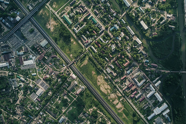
Urban Monitoring
Town/Urban planners can derive real-time insights into urban sprawl, growth trends and prepare new master plans. By analysing high-resolution imagery, governments can make data-driven decisions for infrastructure planning, resource allocation, and sustainable urban development vis-a-vis periodic monitoring of large construction projects.

Pollution Monitoring
EARTHEYE’s self-service satellite tasking platform enables government agencies to track and analyse pollution levels in real time. By leveraging multi-sensor data, it is possible to identify sources of air and water pollution while effectively tracking compliance to regulations by large industries.
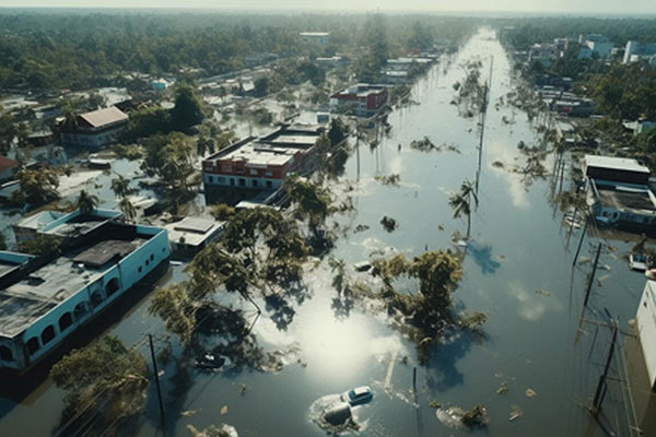
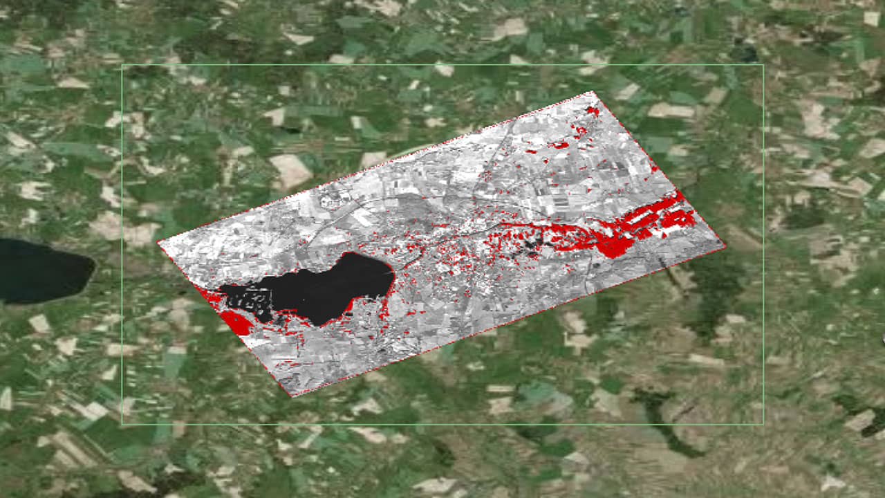
Flood Monitoring
Climate change has led to increased frequency and intensity of Urban floods leading to loss of life and properties. EARTHEYE platform enables government agencies to detect and monitor flood extents in near real time. By leveraging high-resolution, all weather satellite imagery authorities can assess flood extent and impact, improve disaster response, and enhance preparedness for future events.
Landcover
Rapid urbanisation and population growth is leading to stress on resources. New construction within current urban extent and upcoming new development in surrounding areas needs to be monitored for improved governance and planning for sustainable development. EARTHEYE self tasking platform helps governments in meeting these challenges through timely data availability and customised analytics.
Smart Tasking, Smarter Information
Near real-time satellite tasking and automated information extraction
Information As A Service – FEEDS
Transform raw satellite data into actionable information instantly with EARTHEYE Feeds. EARTHEYE delivers decision-ready information by extracting essential details from multi-sensor data, supported by automated detection, classification, and reporting across sectors such as defence and intelligence and areas like climate change.
Starting at USD 100 per feed


