Industry Application
Utility

Application
EARTHEYE’s self-service satellite tasking platform offers advanced applications to monitor renewable energy assets, detect infrastructure vulnerabilities, and track changes in power grids. Gain precise insights to optimise operations and ensure reliable energy delivery.
- Monitor renewable energy assets
- Detect infrastructure vulnerabilities
- Track power grid changes
EarthEye’s Impact

EARTHEYE empowers the utility industry to maintain energy efficiency, minimise downtimes, and achieve sustainability goals through advanced satellite insights and data-driven decision-making.
- Maintain energy efficiency
- Reduce downtimes
- Support sustainability goals
Use Cases
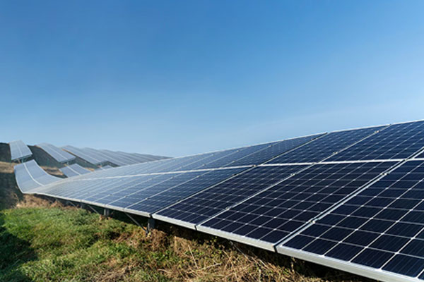
Rooftop Analysis
EARTHEYE platform enables utility companies to accurately estimate rooftop types and areas using high-resolution satellite imagery. This capability supports solar energy planning, infrastructure development, and asset management. By leveraging self-service satellite tasking, utility companies can assess rooftop suitability for solar panel installation, optimise energy distribution, and monitor structural changes over time. EARTHEYE’s platform streamlines data acquisition, reducing costs and improving decision-making for sustainable energy initiatives.

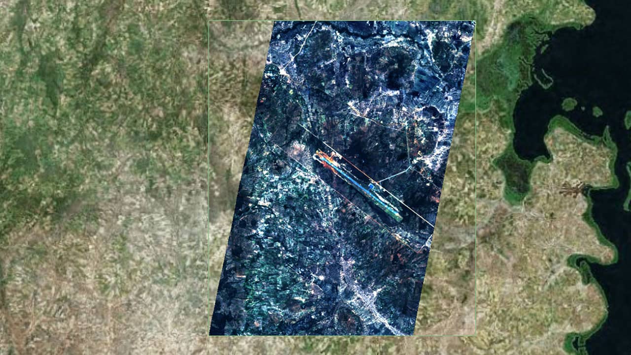
Route Monitoring
Laying of oil and gas pipelines and power transmission lines have to pass through remote and challenging terrain conditions. High resolution satellite images and Digital Elevation Models from EARTHEYE tasking platform effectively reduces risk, costs and time involved in preliminary ground based reconnaissance surveys. Whereas for operational networks, vegetation overgrowth and encroachments, monitoring oil leaks, our platform enhances efficiency in maintenance, prevents outages, and reduces inspection costs.

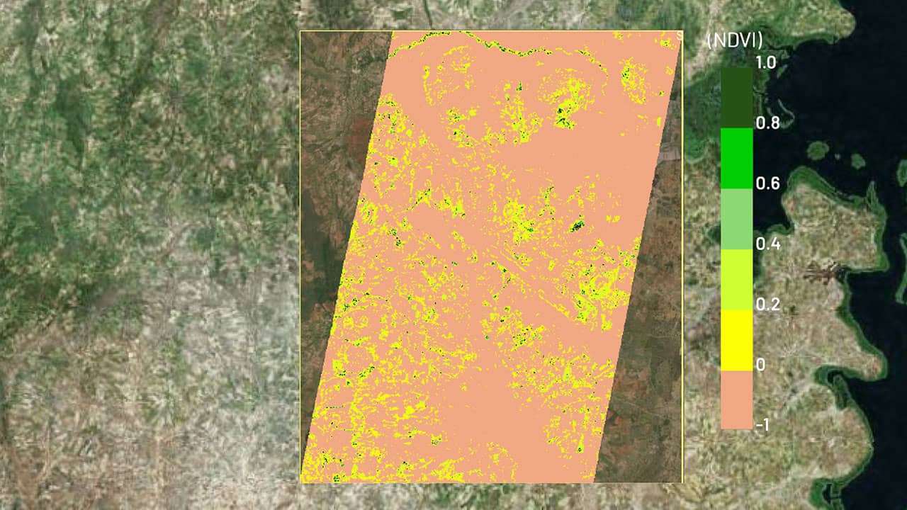
Vegetation Management
NDVI (Normalised Difference Vegetation Index) is one of the earliest and most widely used indices for assessing vegetation health. It reflects the chlorophyll content in plant leaves, making it possible to distinguish between healthy and stressed (diseased or nutrient-deficient) vegetation. NDVI is also commonly applied in mapping and differentiating land use and land cover types.

Asset Monitoring
EARTHEYE enables periodic asset monitoring for Rail-Road, Dam construction project progress tracking. With automated tasking of multi-sensor satellites, companies can optimise resources, mitigate risks, and ensure timely project completion with complete transparency.
Smart Tasking, Smarter Information
Near real-time satellite tasking and automated information extraction
Information As A Service – FEEDS
Transform raw satellite data into actionable information instantly with EARTHEYE Feeds. EARTHEYE delivers decision-ready information by extracting essential details from multi-sensor data, supported by automated detection, classification, and reporting across sectors such as defence and intelligence and areas like climate change.
Starting at USD 100 per feed


