How Earth Observation is Empowering Local Governments
Earth Observation (EO) technology is fundamentally changing how public authorities address these challenges. By harnessing satellite-based data, local governments can enhance community safety, optimise urban planning, and meet environmental obligations with measurable improvements in efficiency and precision.
Advanced Wildfire Management Through Multi-Sensor Monitoring

Eartheye Space’s access to hundreds of satellite sensors enables comprehensive wildfire management through:
- Predictive monitoring: Continuous assessment of vegetation health, biomass levels, and moisture content to identify high-risk areas
- Real-time response: Optical, thermal, and radar sensor tasking during active fire events for immediate situational awareness
- Strategic planning: Data fusion with meteorological models to predict fire spread patterns, optimise evacuation routes, and enhance crew deployment strategies
- Recovery assessment: Post-fire monitoring of burn scars and vegetation recovery patterns
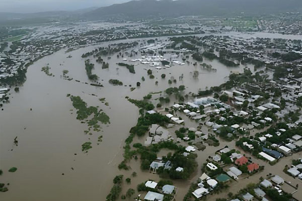
Transforming Flood Risk Management

EO solutions provide local governments with essential capabilities:
- Dynamic risk assessment: Current land use mapping, terrain analysis, and flood modeling for accurate risk evaluation and insurance planning
- Emergency response: Rapid satellite tasking during flood events delivers near-real-time data to support evacuation decisions and resource deployment
- Economic impact: Research demonstrates up to 8× return on investment for proactive flood mitigation programs supported by satellite data
Integration of current satellite data into municipal planning and emergency response protocols significantly enhances disaster resilience while reducing economic losses.
Precision Emissions Monitoring for Climate Compliance

EO-powered emissions monitoring addresses these limitations by enabling:
- Wide-area surveillance: Comprehensive scanning for methane plumes with automated triggering of high-resolution follow-up observations
- Source identification: Detection of both point sources and diffuse emissions, with optional optical imagery integration
- Impact modeling: Advanced dispersion modeling using meteorological datasets to assess potential environmental and health impacts
- Regulatory support: Compliance monitoring across sectors including landfill operations, energy infrastructure, and waste management
This framework supports data-driven emissions reduction strategies and transparent environmental governance.
Smart Urban Development and Infrastructure Planning

EO technology enables local governments to:
- Monitor urban dynamics: Regular mapping and analysis of urban environments to track development patterns and identify emerging challenges
- Integrate workflows: Analysis-ready data feeds from optical, SAR, and hyperspectral sensors directly into existing GIS systems and planning workflows
- Evidence-based planning: Support for zoning decisions, infrastructure investments, and climate-resilient urban design initiatives
This approach creates a comprehensive, evolving understanding of urban environments that adapts to changing conditions and requirements.


